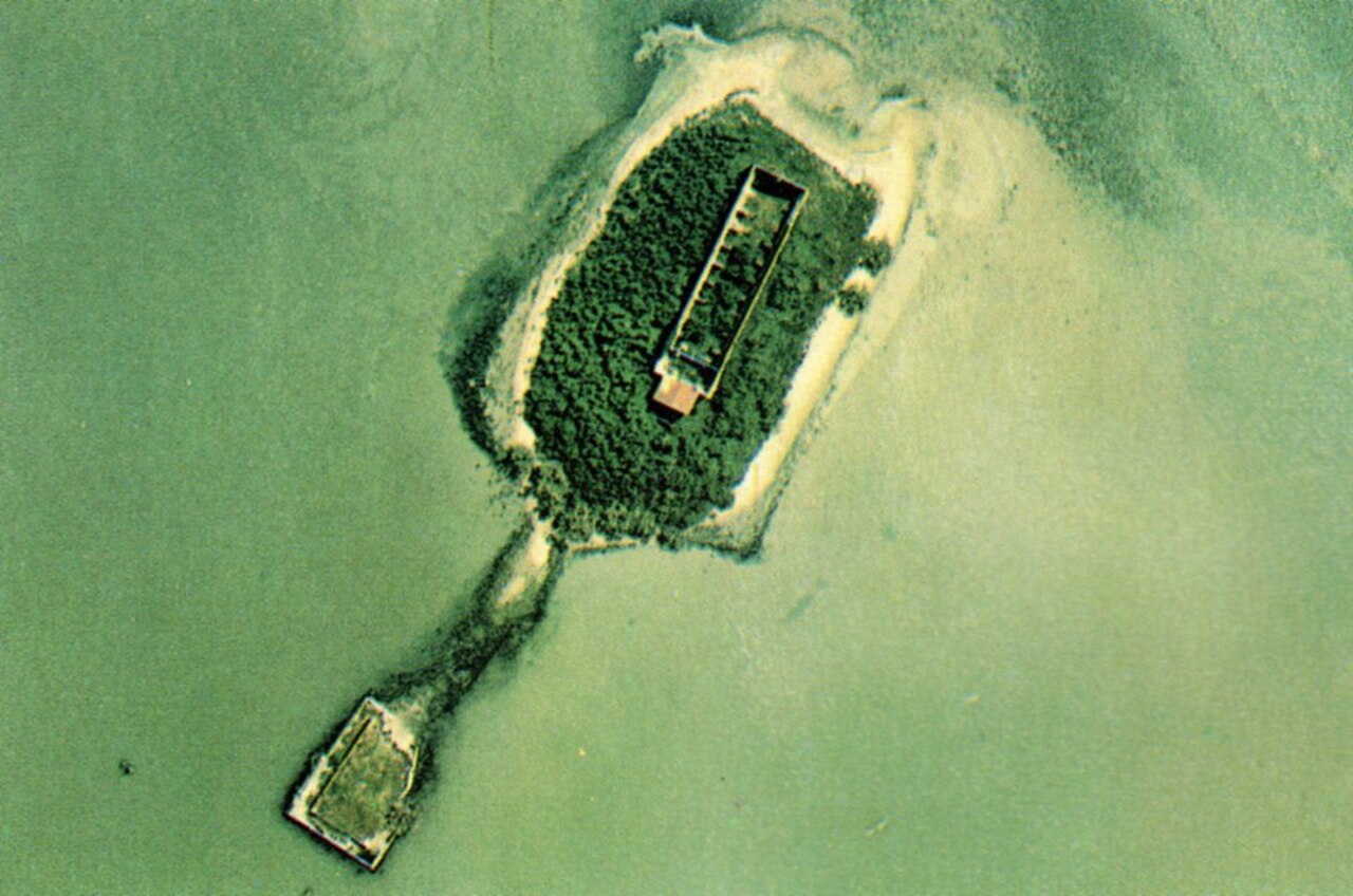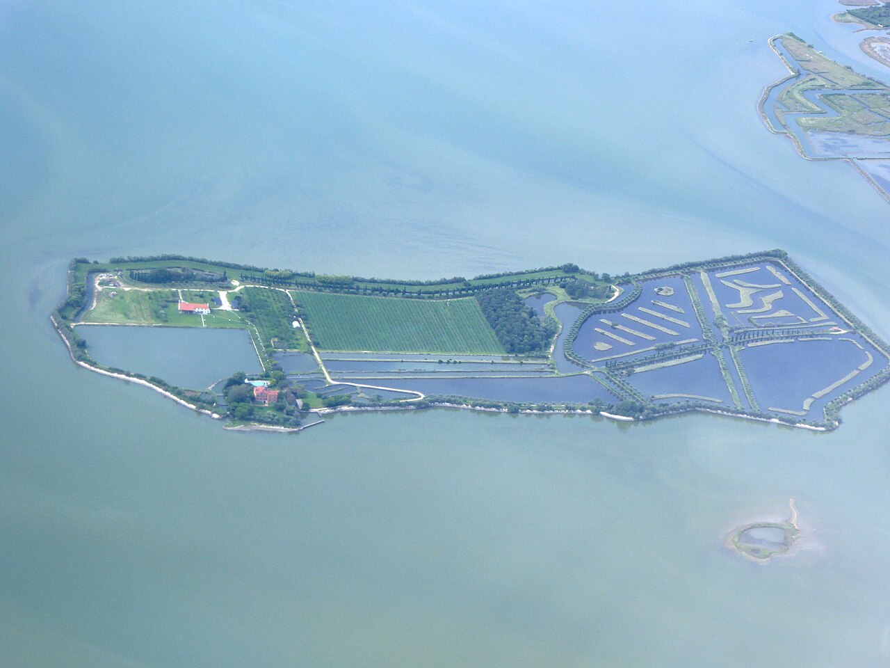
Few islands tell the story of Venice’s vanished settlements as powerfully as Sant’Ariano. Once part of the thriving early medieval landscape of Costanziaco, it later became a Benedictine monastery and then an immense island ossuary.
Sant’Ariano and the vanished landscape of Costanziaco
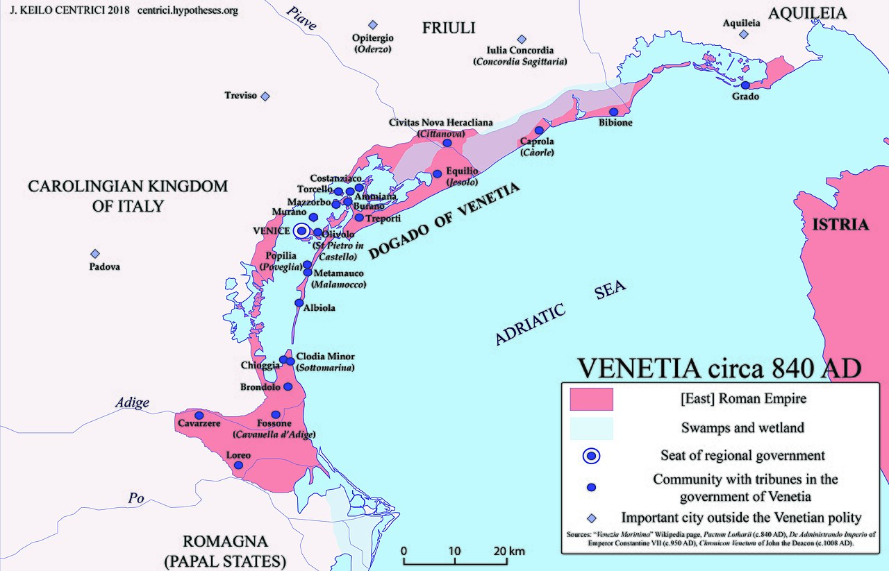
Sant’Ariano is a small, isolated island north-east of Torcello in the northern Venetian Lagoon. It is one of the last surviving pieces of Costanziaco, an extensive early medieval settlement whose islands and channels gradually changed or vanished. To understand Sant’Ariano is to explore an earlier geography of Venice: a network of religious centres, homes, cultivated land and bridges that no longer appears on modern maps. It is not a regular tourist attraction or public waterbus destination.
Costanziaco from the sixth to the eleventh century
The northern lagoon was densely settled in parts of late antiquity and the early Middle Ages. Costanziaco was associated with the movement of people from the mainland and with the development of religious institutions close to Ammiana and Torcello. The surviving evidence is fragmentary because tidal erosion, sediment movement and abandonment transformed the landscape. Archaeologists have identified traces of buildings and crossings around the channels, reminding us that the isolated island today was once part of a much larger community.
The Benedictine monastery of Sant’Adriano
Historical accounts place the foundation of a female Benedictine monastery dedicated to Saint Adrian the Martyr around 1160. The name Sant’Ariano is the Venetian form of Sant’Adriano. Nuns from prominent Venetian families joined the community, which held property and received income from benefactors. Monasteries were spiritual institutions but also landholders and important social organisations. Other nearby religious foundations, including San Maffio, formed part of Costanziaco’s complex ecclesiastical history.
Environmental change and the departure of the nuns
As land was progressively eroded and local waterways changed, life became increasingly difficult. The Benedictine nuns left Sant’Ariano in 1439, moving to Sant’Angelo di Zampenigo at Torcello; later institutional changes linked their community with other Venetian houses. By the fifteenth century much of ancient Costanziaco had been abandoned. The disappearance of its inhabited islands was gradual, not the result of a single flood that swallowed a city overnight.
1565: the creation of Venice’s island ossuary
A dramatic new use began in 1565, when Sant’Ariano became an open-air ossuary. Human bones removed from overcrowded cemeteries in Venice were brought here by boat. A perimeter wall, described in historical studies as approximately 101 by 65 metres and around three metres high, enclosed the area. This was a practical response to burial space and public-health management, rather than evidence that the island was a place of ritual violence. It remained in use for centuries, with deposits reported until 1933.
The wall, ruins and stories about human remains
The island’s most striking historical trace is the enclosed burial area. Accounts by researchers describe deposits of human bones, remnants of walls and signs of former ecclesiastical buildings. Some popular stories treat Sant’Ariano as a sinister or haunted place, but archaeological investigation tells a different story about urban needs, burial practices and environmental decline. The remains deserve respect: this was a place where the dead were deposited, not a spectacle to be disturbed or collected.
The archaeological rediscovery of Costanziaco
The Costanziaco Project, involving Ca’ Foscari University and the archaeological heritage authorities, undertook field investigations from 2008. Research identified evidence for medieval occupation, religious structures and an old wooden bridge recorded in historical mapping. The work contributes to understanding settlement before the centralisation of population around Venice. Scholarly studies, including research published in 2022, encourage readers to distinguish documented archaeology from the exaggerated legends surrounding the island.
What can be seen today?
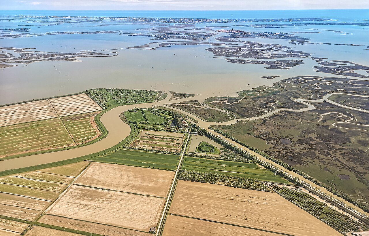
Sant’Ariano remains an isolated and fragile site amid the waterways and marshes of the northern lagoon. Vegetation and erosion affect the ruins, and the former ossuary is not maintained as a regular public museum. There is no ordinary ACTV connection and no reason to assume that boat passengers may freely disembark. Unauthorised access could damage archaeological remains and disturb human burials. A view from permitted navigable waters, when practical, is different from an authorised archaeological visit.
Sant’Ariano and Venice’s other historical islands
Sant’Ariano connects several major themes of Venetian history: the vanished communities of Torcello and the northern lagoon, monastic life, the city’s management of burial and the constant movement of land and water. Another island with a history of remembrance is San Michele, now Venice’s main cemetery. Comparing the two shows how approaches to burial changed over centuries.
Explore the northern lagoon from the water
The remains of Costanziaco are most meaningful when interpreted within the wider northern lagoon. A private boat itinerary can introduce the history of Torcello, the nearby waterways and the landscape that once supported vanished settlements. Contact us to discuss a suitable private route, subject to navigational rules, conditions and local access restrictions. Landing on Sant’Ariano is not included or guaranteed.
Why the perimeter wall is historically significant
The wall built around the ossuary was part of a deliberate response to the practical needs of an increasingly populous Venice. Cemetery space within the city’s parishes was limited, and periodic clearance of burials created large quantities of human remains. Transporting bones to an outlying island meant they could be stored away from daily urban activities while retaining a recognisable enclosed location. The wall was therefore an infrastructure of burial management, not a military fortification. Understanding its function helps explain the unusual geometry of Sant’Ariano, which differs from many irregular lagoon islets.
Reading the archaeological landscape
Field research must distinguish different layers: traces of the Benedictine monastery, remains of medieval Costanziaco, later ossuary walls and modern vegetation. The university-led investigations that began in 2008 combined documentary study with observations of surviving structures. Research published by Daniele Rampazzo in 2022 also explains that archaeological evidence should be separated from the island’s sensational legends. Visitors who read about human remains should remember that the site is simultaneously an archaeological landscape and a former burial place.
A landscape shaped by erosion
The fate of Costanziaco was not unique. The northern lagoon has always been influenced by river sediments, tides, changes in navigable channels and the gradual movement of people towards more stable centres. Ammiana also lost many settlements and monasteries, while Torcello survived in reduced form. These stories make Sant’Ariano important for understanding Venice before Venice: the familiar map of islands is the outcome of many centuries of environmental and human change, not a fixed geography.
Frequently asked questions
What was Sant’Ariano before it became an ossuary?
It was part of medieval Costanziaco and had a Benedictine convent dedicated to Saint Adrian.
When did Sant’Ariano become an ossuary?
The burial use is documented from 1565 and continued, in different forms, until the twentieth century.
Why did the nuns leave the island?
Environmental deterioration and changing settlement conditions led to their departure in 1439.
Can visitors enter Sant’Ariano?
It is not an ordinary publicly accessible island; entry must not be assumed or attempted without permission.
Explore more: discover the history of the other Venetian Lagoon islands.
Explore the lagoon by boat: discover our private boat tour in the Venetian Lagoon. Routes are customisable; stops and island access depend on permissions and navigation conditions.
Historical sources and image credits
Daniele Rampazzo, Sant’Ariano: l’isola ossario (2022); Venice State Archives: ancient northern lagoon; Treccani. Image: Didier Descouens / Wikimedia Commons, CC BY-SA 4.0; contextual aerial photograph, not Sant’Ariano itself.