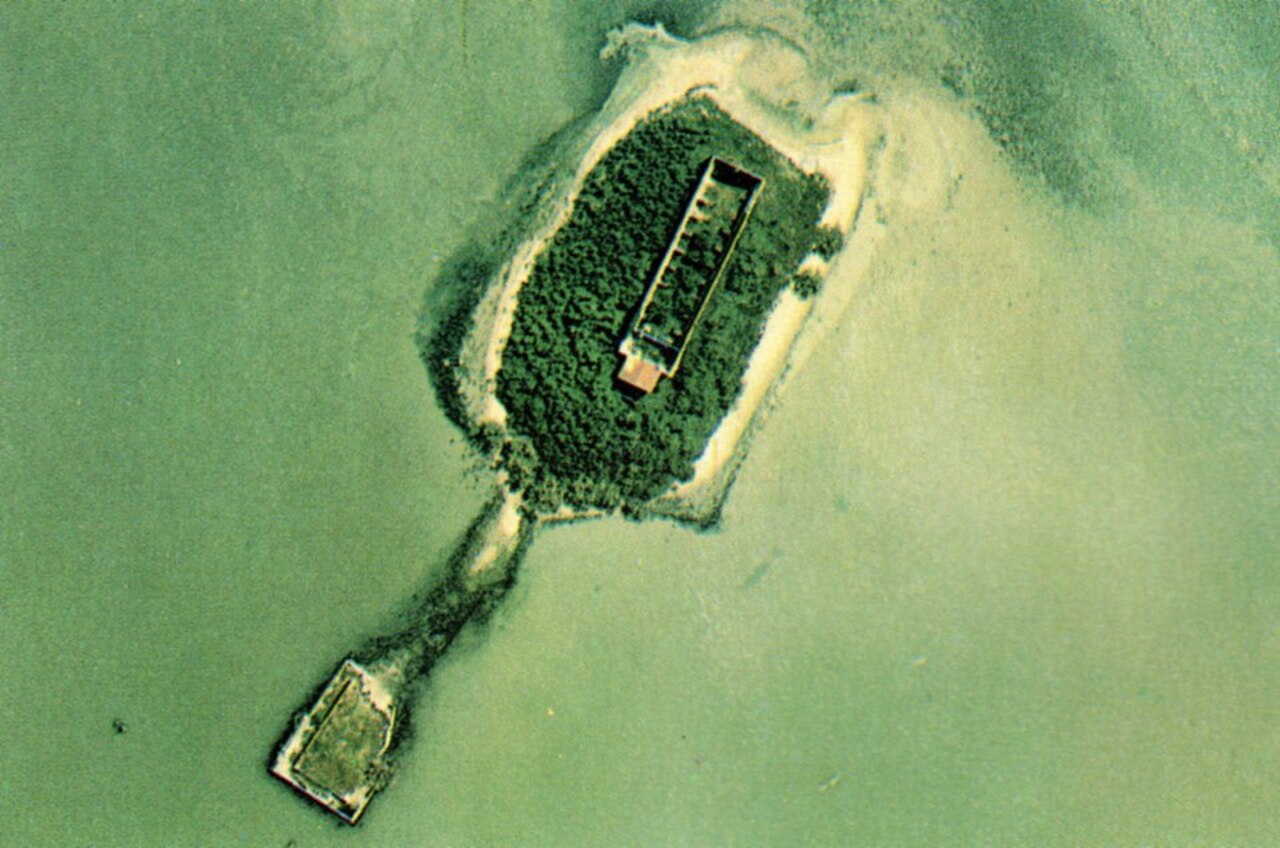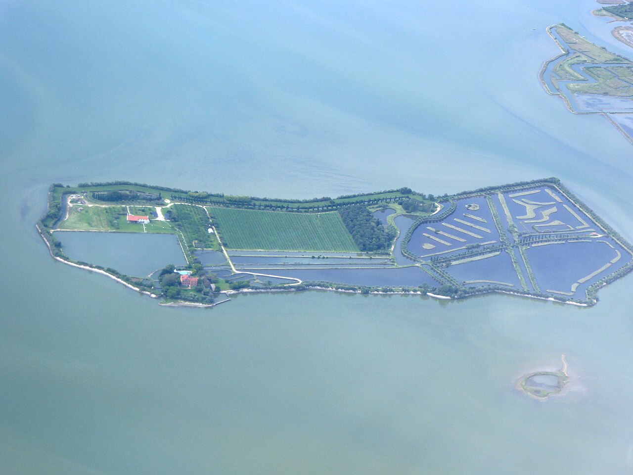
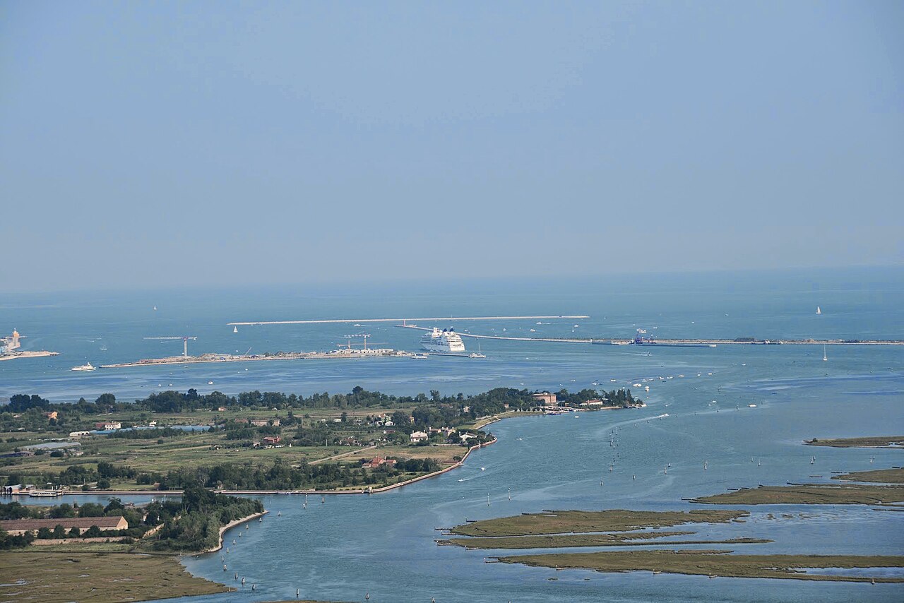
Long before Venice became a destination for visitors from around the world, the city depended on islands that produced food, salt and wine. Sant’Erasmo is one of the clearest examples. The broad green fields of this northern lagoon island have supplied Venetian kitchens for centuries, while its coastline, old boundary stones and military tower tell a second story: the changing relationship between Venice and the Adriatic Sea.
The history of Sant’Erasmo island is not simply the story of its famous violet artichoke. It is the history of a former coastal barrier, a working rural community and an agricultural landscape that still forms part of everyday Venetian life.
Where is Sant’Erasmo in the Venetian Lagoon?
Sant’Erasmo lies in the northern Venetian Lagoon, near the islands of Le Vignole and Lazzaretto Nuovo and within the wider area between Venice, Murano and Treporti. Approximately four kilometres long, it is the lagoon’s second-largest island and one of its most distinctive inhabited rural landscapes.
Unlike the dense urban fabric of central Venice, the island has scattered houses, farm buildings, orchards, vegetable plots and quiet roads. It is still a working place rather than a historic district converted entirely to tourism. Much of its cultivated land is privately owned.
Before it became an island inside the lagoon: an ancient Adriatic shore
One of the most surprising facts about Sant’Erasmo is that its position has changed in relation to the sea. Until the late nineteenth century, it formed part of the coastal barrier separating the Venetian Lagoon from the Adriatic.
That changed as the great breakwaters at the Lido inlet were constructed and the sandy shoreline of the Cavallino–Punta Sabbioni area developed. Sant’Erasmo increasingly became an inner-lagoon island, sheltered from the open sea.
This earlier geography explains its sandy soils, the traces of coastal dunes and its defensive importance. The island’s present-day calm is the result of centuries of natural processes and maritime engineering, not a landscape that has always been exactly as it is today.
From Lido Maggiore to Sant’Erasmo: the island’s old names
Over the centuries, the island was associated with names including Lido Maggiore, Lido Albo, Lido Bromio and Pineta Maggiore. These names reflect its position on an older coastal strip and changing local traditions.
Archaeological evidence indicates longstanding use of the area along the waterways linking the northern Adriatic with Altino and Aquileia. It should not be imagined as a single ancient town: settlement was historically dispersed, with small agricultural and maritime communities developing over a long period.
Salt production and the medieval lagoon economy
Before Sant’Erasmo became famous as Venice’s vegetable garden, its coastal position supported activities connected with salt production. The F’Orti historical project records how tidal waters and the island’s climate sustained salt-making until approximately the twelfth century.
Salt was essential to food preservation and commerce in medieval Venice. Its production and movement through lagoon channels linked places like Sant’Erasmo to the wider Adriatic economy.
As the use of land changed, cultivation became increasingly important. Vegetable gardens, small vineyards and local transport by boat helped the island support Venice without abandoning its maritime identity.
Why Sant’Erasmo became the vegetable garden of Venice
For centuries, Sant’Erasmo has been called the “Orto della Serenissima” or the “Garden of the Doges”. The nickname reflects the island’s contribution to the food supply of Venice, where growing fresh produce was difficult among the city’s canals and buildings.
A combination of well-drained sandy soil, lagoon moisture, a relatively mild microclimate and generations of farming knowledge made the island suited to vegetables, vines and other crops. Family farms used small fields bounded by ditches and canals. Maintaining those water boundaries was part of agricultural work.
Produce traditionally travelled from the island to the markets of Venice by boat. The relationship between Sant’Erasmo and the Rialto Market shows how the lagoon was not just a scenic setting around the city, but a working network essential to feeding its inhabitants.
Vineyards before artichokes: the agricultural past of Sant’Erasmo
The island is now particularly associated with artichokes, but vineyards once occupied an important part of its agricultural landscape. Local traditions preserve this memory: residents have long used the word vigna for cultivated plots, even when they are planted with vegetables rather than grapes.
Vine growing has never disappeared entirely. Together with seasonal vegetable cultivation, it remains part of the island’s cultural identity. The fields visible today are the result of continuous adaptation as economic demand, climate and farming techniques change.
The violet artichoke and the first tender castraure
The most celebrated product is the violet artichoke of Sant’Erasmo, a local variety protected by a Slow Food Presidium and promoted by a producers’ consortium. Its elongated shape, violet-coloured bracts and delicate flavour make it one of the symbols of Venetian seasonal cuisine.
The harvest begins towards late April with the castraure, the first small apical bud removed from each plant. Farmers cut that bud to encourage later growth, which is why the earliest artichokes are particularly prized and available only for a short period. Subsequent buds are known locally as botoi or botoli; the harvest typically continues into early summer.
The castraure are often served raw with olive oil, salt and pepper, or prepared using traditional Venetian recipes. This culinary heritage is not a reason to enter private fields: farm visits and tastings, where offered, must be agreed directly with their organisers.
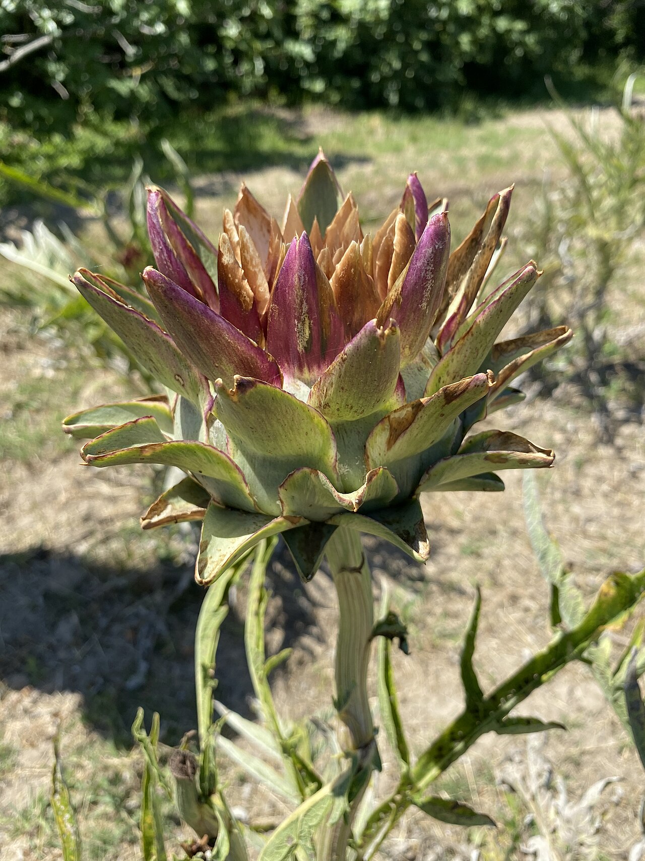
The historic boundary stones that marked the lagoon
Scattered through the fields are stone markers known as cippi di conterminazione lagunare. They date from a programme begun by the Venetian Republic in 1791 to define the lagoon’s official boundaries.
The Venezia Unica tourism authority identifies 16 boundary stones on Sant’Erasmo, numbered 29 to 44 within the broader series. They are remarkably tangible evidence that the lagoon’s limits were once a matter of administration, engineering, navigation and environmental protection.
Because several stand near fields or roads, some may be visible during a walk. They should be admired from permitted routes, without trespassing on private agricultural land.
Fortifying the Lido entrance: the Torre Massimiliana
Sant’Erasmo’s position on the older coastal barrier made it strategic for defending ships’ routes towards Venice. Today the most striking surviving monument is the Torre Massimiliana, a circular brick military tower close to the Bacàn shore.
The tower was constructed under Austrian rule in 1843–1844 on the site of a previous French fortification developed between 1811 and 1814. Its round form allowed observation and defensive fire in several directions.
The name recalls Archduke Maximilian of Austria, associated with the tower during the revolutionary events of 1848. The building later lost its original military function and was restored for cultural and community uses.
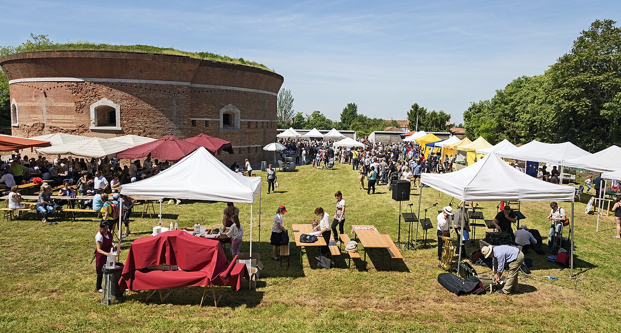
The Torre Massimiliana in 2026: exhibitions and community heritage
Following restoration, the tower has been used for exhibitions, agricultural festivals and community events. In April 2026, the City of Venice approved guidelines for a proposed three-year management arrangement involving a partnership led by Coldiretti with local agricultural and cultural organisations.
The intention is to combine the building’s heritage value with support for the island’s local products and traditions. Opening is event-dependent rather than guaranteed every day, so visitors should check the municipality’s current announcements before planning an interior visit.
The Bacàn shore and the island’s relationship with water
Near the tower is the Bacàn, a sandy shore popular with Venetian residents in warmer weather. It is another reminder of Sant’Erasmo’s earlier coastal character. The nearby shoals and currents make this part of the lagoon different from the urban canals of central Venice.
In summer, boats may gather offshore, but visitors must respect navigation rules, local bathing conditions and any temporary restrictions. The shore is not a promise of organised beach facilities or unrestricted mooring.
Chiesa del Cristo Re and life on a farming island
The island’s Church of Christ the King (Cristo Re) dates from the twentieth century and was designed by architect Brenno Del Giudice. Its three-nave layout belongs to a more recent chapter of the local community’s history than the medieval agricultural traditions.
Historically, Sant’Erasmo had dispersed rural settlements rather than a single tightly built centre. Farming families, seasonal workers and people arriving by boat shaped its everyday rhythms. Agriculture remains visible in the fields, houses and small roads rather than in monumental public squares.
The Festa del Carciofo Violetto and the Festa del Mosto
Two celebrations connect the island’s agricultural history with present-day community life. The Festa del Carciofo Violetto is normally held in spring, often in May, celebrating the season’s prized produce. The Festa del Mosto celebrates the grape harvest and rural traditions in autumn.
The City of Venice documented the 48th Festa del Mosto on 4 October 2026, with local produce, traditional crafts, music, grape pressing and a Venetian rowing race. These events reflect living community traditions rather than historic reenactments created for tourists. Dates and access arrangements should always be checked for the specific year.
How to visit Sant’Erasmo from Venice
Sant’Erasmo is accessible on the public ACTV line 13, which links Fondamente Nove, Murano, Le Vignole, Sant’Erasmo and Treporti, subject to the operating timetable. Stops serving the island include Capannone, Chiesa and Punta Vela, although services and calling patterns can vary.
Its roads and permitted paths make it attractive for unhurried walks and, where practical, cycling. Private vegetable plots, vineyards and farm buildings are not automatically open to visitors. The tower’s interior and organised agricultural experiences may require specific dates, reservations or permissions.
Consult the official ACTV timetable and Venezia Unica’s visitor guide for current information.
Explore the agricultural islands of Venice by private boat
The history of Sant’Erasmo makes more sense when viewed from the lagoon: fields face the water, farm boats connect islands and the Torre Massimiliana stands where a former coastal defence watched over maritime routes.
It connects naturally with the history of nearby Le Vignole and Lazzaretto Nuovo. For more about the island’s food traditions, read our guide to Sant’Erasmo’s vegetables, honey and wine or our boat-trip guide.
To discuss a personalised route, discover our private boat experiences in the Venetian Lagoon or contact us. Landings and visits to farms or historic buildings depend on arrangements and permissions.
Discover more in History of the Venetian Lagoon Islands.
Frequently asked questions
Why is Sant’Erasmo called the vegetable garden of Venice?
For centuries its fertile fields and family farms supplied vegetables and other produce to Venice, including the markets around Rialto.
What are the castraure of Sant’Erasmo?
They are the first tender apical buds of the violet artichoke, cut in spring to encourage further growth. They are particularly prized in Venetian cuisine.
When was the Torre Massimiliana built?
The present Austrian tower was built between 1843 and 1844 over an earlier French fortification; it now hosts cultural and agricultural events subject to opening arrangements.
Can you visit Sant’Erasmo by public waterbus?
Yes. ACTV line 13 serves the island from the Fondamente Nove area via Murano and Le Vignole, with stops and schedules to confirm before travelling.
Historical sources and photographic credits
Sources: F’Orti – history of Sant’Erasmo; Venezia Unica – Sant’Erasmo; Veneto Region – violet artichoke; City of Venice – Tower management, April 2026; City of Venice – 2026 Festa del Mosto. Featured image: Anton Nosik / Wikimedia Commons, CC BY 3.0, resized to 1280 px. Inline photographs credited in captions.